You can drive to the end of the road. Route 550 climbs about 19 miles from Waimea town, along the rim of Waimea Canyon and on through Kōkeʻe State Park, to Puʻu o Kila on the rim of the Kalalau Valley. It takes an hour without stops, and every lookout on the way has been open since the state reopened both parks on Saturday 7 November 2026. Some trails and services are not back yet, as set out below, and the campground has been closed for construction since May.
Waimea Canyon is the deep, colorful gorge on the island’s west side, seen from the lookouts of Waimea Canyon State Park. Above it, Kōkeʻe is a forest plateau of 4,345 acres between about 3,200 and 4,200 feet, with a museum, a lodge, the trails and, at the top, the view down the Kalalau Valley to the sea. Both have been public parks since 1952, set aside by the Territory of Hawaiʻi. What is open on Kauaʻi has the parks’ status, dated, and Waimea Canyon tours the ways up without driving.
The road and its lookouts
Two roads climb to the canyon. Waimea Canyon Drive leaves Kaumualiʻi Highway in Waimea town, and Kōkeʻe Road (Route 552) leaves Kekaha; they meet about 7 miles up, and from there the road is Kōkeʻe Road, still Route 550, to its end. The mile markers count from the foot of Waimea Canyon Drive, and so do the miles below, by road and rounded to the half mile.
| Mile | Stop | What is there |
|---|---|---|
| 8.75 | Iliau Nature Loop and the Kukui Trail | A short roadside loop with views into Waimea and Waiʻalae canyons, and the trail down to the canyon floor |
| 10.5 | Waimea Canyon Lookout | The main view across the canyon, at 3,400 feet by the state’s sign |
| 13 | Puʻu Ka Pele | A lookout and picnic area on the canyon rim |
| 13.5 | Puʻu Hinahina | Another view down the canyon, a viewpoint west to Niʻihau nearby, and one end of the Canyon Trail |
| 15.5 | Kōkeʻe State Park headquarters | The Kōkeʻe Museum, the Kōkeʻe Lodge and the Nuʻalolo trailhead |
| 17 | Awaʻawapuhi trailhead | Parking for the Awaʻawapuhi Trail |
| 18 | Kalalau Lookout | The Kalalau Valley from about 4,000 feet, down to the sea |
| 19 | Puʻu o Kila | The end of the road, the same valley from its rim, and the Pihea trailhead |
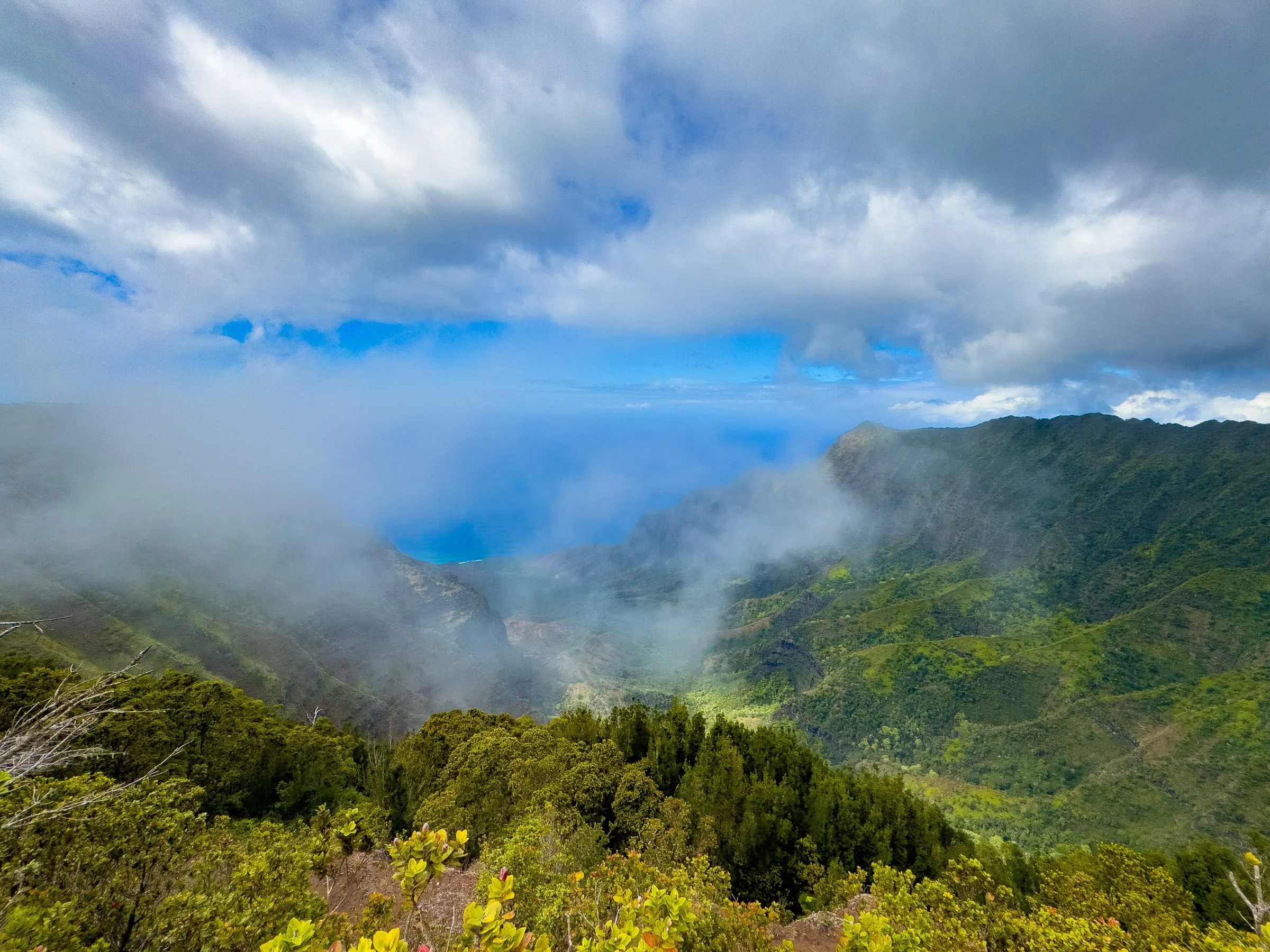
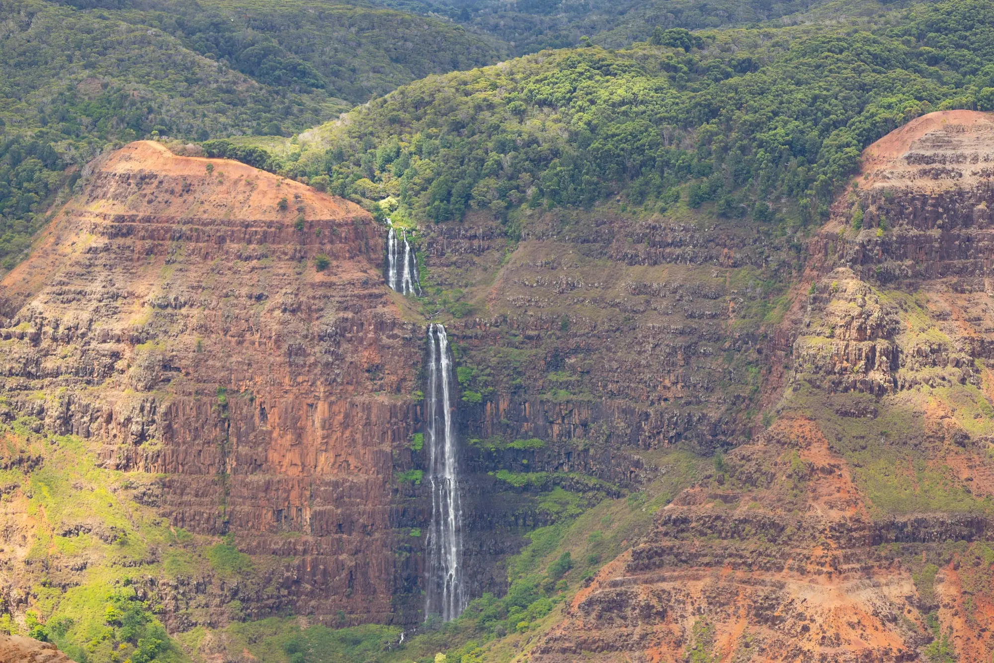
The canyon lookouts look across Waimea Canyon, its walls banded red, ochre and green, and from them you see Waipoʻo Falls drop in two tiers into the canyon, as in the photograph at the top of this page. The top two look down into the Kalalau Valley, and on a clear day you see down its fluted ridges to the ocean. Cloud drifts in and out of that valley through the day, as in the photograph below, so with a car of your own you can wait at the rim for it to lift.
It is about half an hour from Waimea town to the Waimea Canyon Lookout and an hour to Puʻu o Kila. From Līhuʻe Airport, the visitors bureau’s driving map gives an hour and a quarter to Waimea Canyon and an hour and 40 minutes to the Kalalau Lookout; getting around Kauaʻi has the drive from each base and the rental car. The road is paved to the end, and an ordinary car does it. The dirt forest roads off it are another matter: Mohihi Road, toward the Alakaʻi Swamp trailhead, needs a four-wheel drive when it is wet. The week of 9 November the state highways division had one lane of Waimea Canyon Drive closed on four weekdays, 7 a.m. to 3:30 p.m., for paving and ditch work, and it posts each week’s closures on its Kauaʻi lane-closure page.
After Hurricane Lowell
Hurricane Lowell left the roads blocked, power poles snapped and the parks’ water system out of action on 7 September, and both parks stayed closed for two months while state crews cleared the way for the repairs. The Waimea Canyon Lookout reopened first, on Saturday 24 October. Kōkeʻe and the rest of Waimea Canyon reopened at 6 a.m. on Saturday 7 November, and the state’s release of 8 November opens the whole road:
“All state parks, lookouts and comfort stations between Waimea Canyon lookout and Pihea are now open.”
Two older notices still read otherwise, and both are out of date. The state’s notices page keeps, in its 5 October block, “Kōkeʻe Road remains closed until further notice”; its newer notice of 10 November, reissued on 12 November, reopens both parks without that line. And Kōkeʻe State Park’s own page still carries a July 2025 notice closing the Waimea Canyon Lookout for construction and letting cars only as far as the Kalalau Lookout while the road beyond it was worked on. The same page records Puʻu o Kila reopened on 14 January 2026, before the storm, and the 8 November release takes in every lookout up to Pihea, whose trail starts at Puʻu o Kila.
The same release names the trails open again: the Nuʻalolo Trail, the Awaʻawapuhi Trail only as far as its first mile marker, the Waimea Canyon Trail, the Iliau Nature Loop and the Pihea Trail. Its Waimea Canyon Trail is not the rim trail to Waipoʻo Falls: by the state’s Kōkeʻe trail poster and its trail program, Nā Ala Hele, it is the trail along the canyon floor, from the foot of the Kukui Trail down to Waimea town. Its top end is reached by the Kukui, which is closed below mile 1.75, and the camps on the canyon floor are among those the release keeps closed. The Canyon Trail on the rim is not named in the release either way.
The release keeps closed the Kohua Ridge, Poʻomau Canyon and Kawaikōī Stream trails, the Kukui Trail from mile 1.75 down to the river, and, away from the canyon, the Kuilau Trail, the Kuamoʻo bridge and ʻŌkolehao; the western ridge roads of Puʻu Ka Pele Forest Reserve; and five forest camps in Waimea Canyon. Every other trail on the state’s forest land is, in the release’s words, “ready to open”, and the state’s notice warns of “a reduction in services as work continues to reopen facilities and some trails.” On the day, a sign or a gate at the trailhead is the rule.
The Kōkeʻe Lodge restaurant and the Kōkeʻe Museum were still shut on 10 November. The Kōkeʻe campground was closed before the storm, for improvements from May 2026 “through Spring 2027”, and the release says it stays closed. About half the park’s historic leased cabins were damaged. What is open on Kauaʻi has the latest, place by place, and where the state’s notices disagree.
The trails
The trails start from the road and run three ways: down into Waimea Canyon, out along the ridges to cliff tops over the Nā Pali valleys, and north into the Alakaʻi, a high wet plateau of bog and forest. Lengths are one way, from the state’s trail pages and its Kōkeʻe trail poster.
| Trail | Starts | One way | Where it ends |
|---|---|---|---|
| Iliau Nature Loop | Mile 8.75 | 0.3-mile loop, easy | Back at the road, past labeled native plants |
| Kukui Trail | The Iliau loop | 2.5 miles, difficult | The canyon floor, 2,000 to 2,240 feet down; closed below mile 1.75 |
| Canyon Trail | Puʻu Hinahina, or Halemanu Road | 1.8 miles, moderate | The top of Waipoʻo Falls |
| Nuʻalolo Trail | Near the park headquarters | 3.8 miles, difficult | A cliff top over the Nuʻalolo Valley, at 2,234 feet |
| Awaʻawapuhi Trail | Mile 17 | 3.1 miles, difficult | A ridge top at 2,500 feet over two Nā Pali valleys; open only to mile 1 |
| Pihea Trail | Puʻu o Kila | 3.8 miles, moderate to difficult | Kawaikōī Camp, past the Pihea Overlook and across the Alakaʻi Swamp Trail |
| Alakaʻi Swamp Trail | Mohihi Road, about 2.75 miles in | 3.5 miles, difficult | Kilohana, over the Wainiha and Hanalei valleys |
Along the Kalalau rim: the Pihea Trail. From Puʻu o Kila it follows the rim of the Kalalau Valley, and a short, steep spur leads to the Pihea Overlook, the highest point on that rim. The state’s warning is plain: go no further than the overlook, where the ground turns very steep. The first mile is the easy part, apart from the steep, rutted drop off the lookout at the start, and beyond it the trail is slick clay and deep mud, with some boardwalk. It crosses the Alakaʻi Swamp Trail just before its 1.75-mile point, which is the way into the swamp without the four-wheel-drive road. The state calls the Pihea moderate on its trail page and difficult on its trail poster; in mud, believe the poster.
Across the swamp: the Alakaʻi. Boardwalk over much of it, through native rain forest and shallow bogs, to Kilohana on the edge of the Wainiha pali, where on a clear day you see down the Wainiha and Hanalei valleys to the North Shore. It is often in mist and fog, wet, slippery and muddy, so stay on the boards. Neither the Alakaʻi nor the Pihea allows commercial use, so no paid guide or tour may take you on either.
To the Nā Pali cliff tops: Awaʻawapuhi and Nuʻalolo. Both trails run downhill out to the cliffs, so the climb comes at the end of the day. Awaʻawapuhi descends 1,180 feet by the state’s trail page (1,300 by its trail poster) to a grassy ridge top at 2,500 feet over the Awaʻawapuhi and Nuʻalolo valleys, with a safety railing above a drop of more than 2,000 feet: do not go past it. Nuʻalolo starts near the park headquarters, drops about 1,400 feet in its first mile, and ends at 2,234 feet at a survey marker called Lolo No. 2, with its own railing; the state’s trail page allows about 3 hours for it, its trail poster 5. The 2.1-mile Nuʻalolo Cliffs Trail joins the two for a loop from near the end of Awaʻawapuhi, and the state’s own sources disagree on it: its list of Kauaʻi trails marks it closed, undated; its trail page says it reopened in November 2017; and on 11 November 2026 its trail program, Nā Ala Hele, did not list it closed. Either way, with Awaʻawapuhi open only to its first mile marker since 7 November, the loop and the Awaʻawapuhi view are both out of reach for now. Nuʻalolo, open again to its end, is the cliff-top walk to do this winter.
Into the canyon: Kukui and the Canyon Trail. The Kukui Trail drops 2,000 feet by the state’s trail poster (2,240 by its trail page’s elevation figure) in 2.5 miles to the floor of Waimea Canyon, and the state has it closed below mile 1.75. The Canyon Trail follows the canyon rim to the top of Waipoʻo Falls, 1.8 miles with a drop of about 1,100 feet; the trail is unmaintained, you cannot see the falls from it, and past the stream at the top of the falls landslides have taken it out. The best views of Waipoʻo are the roadside ones. The Canyon Trail and the short trails around Halemanu Road, among them the Cliff Trail’s spur to a view of a side canyon, are not named in the 8 November release either way; its Waimea Canyon Trail is the one on the canyon floor.
For a short walk: the Iliau Nature Loop at mile 8.75, a third of a mile with the plants labeled, or the Kaluapuhi Trail, 1.6 miles of gentle forest just past the Kalalau Lookout.
Fees, weather and what to bring
Fees. A non-resident pays $5 a person to enter, children 3 and under free, and $10 to park a car, once for both parks. In the words of the state’s parks brochure: “One payment for entry and parking covers both Kōkeʻe and Waimea Canyon State Parks.” Hawaiʻi residents with a Hawaiʻi ID or driver’s license pay neither, and no reservation is needed. Kauaʻi state park fees has the fees at every state park on the island.
Weather. It is cooler and wetter than the coast. NOAA’s normals at the park headquarters, about 3,600 feet up, give January days of about 65°F and nights of about 48°F, and 57 inches of rain a year, from 9.6 inches in December to about 2 a month from June to September. Bring a layer and a rain jacket, and check the Weather Service’s forecast for Kōkeʻe before you go up. The best time to visit has the month by month.
Before you go up:
- Fill the tank, or charge the car, before you leave the coast. Help takes hours to arrive at the top of the road, and cell service is limited there.
- Keep to daylight. The parks open daily during daylight hours, rescue crews work in daylight, and a helicopter cannot fly into fog. Start a long hike early.
- Carry water, even for a short walk, and do not drink from the streams.
- Wear shoes with grip. The ridge and rim trails are slick after rain, and where they are dry the loose soil rolls underfoot like ball bearings.
- Do not cross a stream that is high and fast, and on the canyon floor, get to high ground if the water rises.
- Clean your boots before and after, and move no ʻōhiʻa wood or plant parts: the state asks it of every visitor, to slow Rapid ʻŌhiʻa Death.
- Watch for hunters. The state reopened most of the island’s public hunting units on 7 November, and hunting dogs may be off the leash near the trails.
Food, beds and the museum
The Kōkeʻe Museum, which Hui o Laka runs beside the lodge at mile 15.5, has the trail maps, exhibits on the forest and its birds, and staff who know the trails and the day’s conditions. It opens from 10:30 a.m. to 3:30 p.m. on weekdays and to 4 p.m. at weekends. The Kōkeʻe Lodge serves breakfast and lunch, and its kitchen closes at 4 p.m. daily. Both were still shut on 10 November.
The park’s beds are few. The Kōkeʻe Lodge manages its rental cabins, each heated only by a wood-burning stove, and the Civilian Conservation Corps camp of 1935, where Hui o Laka offers overnight stays, took significant storm damage. The state campground is closed through spring 2027. Below the canyon, Waimea town and Kekaha are the closest beds off the mountain, and where to stay on Kauaʻi has the west side.
Without a car
Waimea Canyon tours compares the ways up: the vans, a private tour to the Kalalau Lookout, and Keko Adventure Tours’ ride for riders from age 14, which drives you up through the canyon and Kōkeʻe with three stops, then sends you 11.7 miles down on a bike to the sunset at Kekaha. The Nā Pali by boat, by air or on foot sets the view from the Kalalau Lookout against a boat or a flight. Keko’s ride and Viator’s full list of Kauaʻi trips are at the foot of this page.
Every fact on this page was read from the state parks division’s notices, news releases, park and trail pages, its trail poster and brochure, the state forestry division’s trail program, the state highways division, NOAA, the visitors bureau, the Kōkeʻe Museum, the Kōkeʻe Lodge, OpenStreetMap’s road data, for the miles and minutes, and the state’s sign at the Waimea Canyon Lookout, on 11 November 2026.