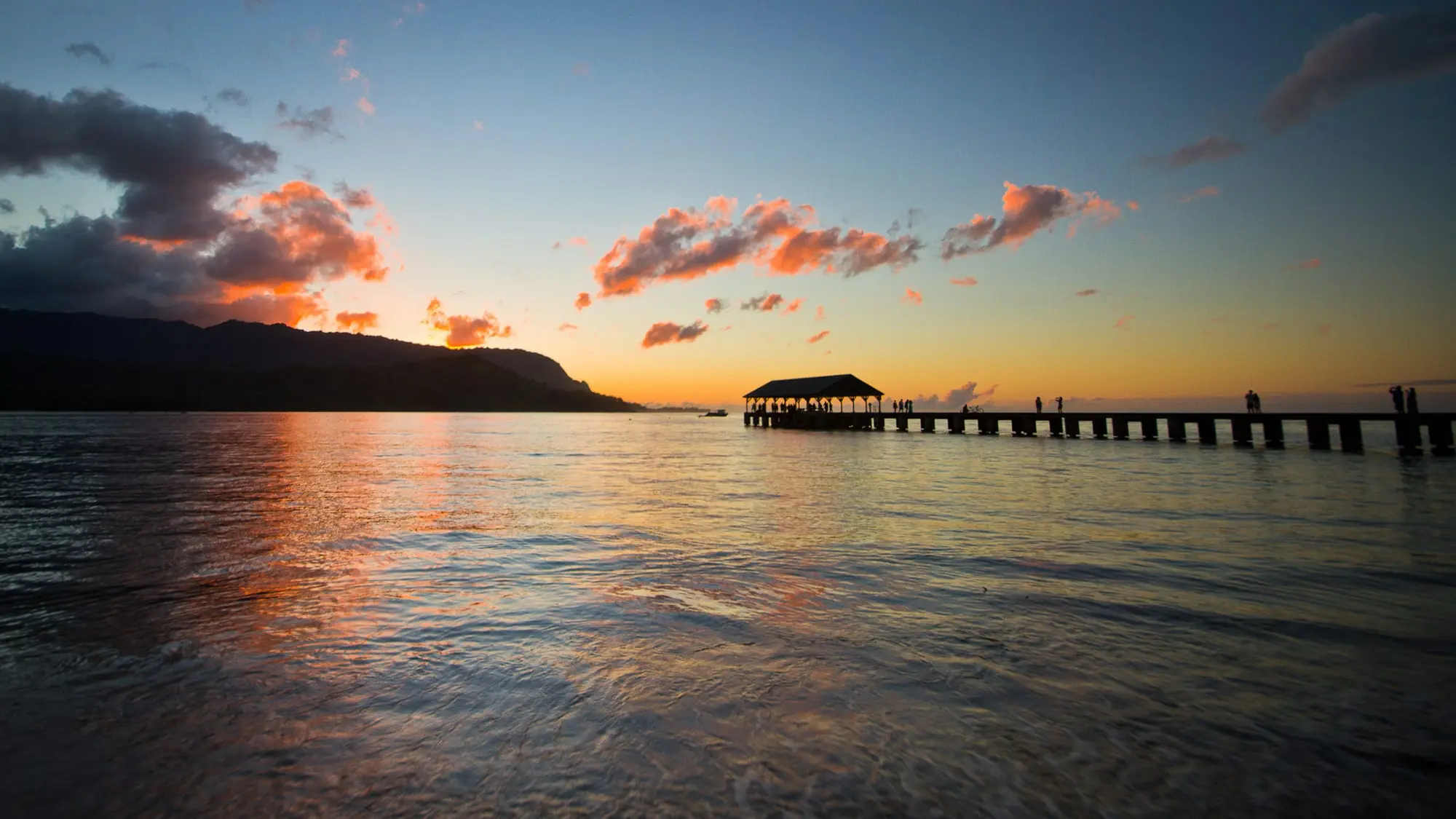
Hanalei Bay is the North Shore’s great curve of sand: about two miles of it, with Hanalei town behind, the pier at its east end and the green ridges of the mountains above. In summer it is a calm bay for a swim. In winter it is a surf break, and the one road in crosses a bridge that closes when the river floods.
Three beach parks on one beach
It is one long beach, but the county runs it as three beach parks, and which one you walk onto decides whether a lifeguard is watching.
| Park | Where on the bay | Lifeguard | What is there | Parking |
|---|---|---|---|---|
| Black Pot Beach Park | The east end of the beach, at the pier and the mouth of the Hanalei River | No tower | A comfort station, a picnic area and the boat ramp | A lot near the end of Weke Road |
| Hanalei Pavilion Beach Park | Between the pier and Waiʻoli | A county tower, 8 a.m. to 6 p.m. every day | The big pavilion, restrooms and showers | A lot near Weke Road and Pilikoa Road |
| Waiʻoli Beach Park (Pine Trees) | Toward the middle of the bay, under ironwoods | A county tower, 8 a.m. to 6 p.m. every day | Restrooms, showers and a picnic area | Two lots, near Heʻe Road and ʻAnae Road |
The pavilion is the family beach. The lifeguards describe it as popular for swimming, surfing and bodyboarding, with the bathroom, the showers and the large pavilion behind the sand. Pine Trees is the surfers’. Its waves can be large, and the lifeguards’ first advice there is to check with them before you go in.
Each tower watches the water in front of it, not the whole bay. The state Health Department’s list carries the two as “Hanalei Bay: Pavillion Tower” and “Hanalei Bay: Pinetrees Tower,” both staffed from 8 a.m. to 6 p.m. seven days a week. Black Pot and the pier have no tower of their own, and outside those hours no part of the bay is guarded. Kauaʻi ocean safety has the island’s other towers and how to read the day’s warnings.
Summer is the swimming season
The bay opens to the north, and the North Pacific sets its calendar. From May to September the swell drops, and the water off the pavilion is where the families swim. The state’s boating division keeps its own season for the bay, a month longer: boats may moor offshore “from May — October” and not in winter.
The lifeguards call it one of the most popular beaches on the whole island, and its parking is the four county lots in the table.
Winter belongs to the surf
From October to April the big swells come out of the north and northwest, and Hanalei Bay becomes one of the North Shore’s surf breaks. The lifeguards put Pine Trees plainly: in winter it “can be very dangerous due to the strong currents and high surf conditions,” and “you’ll find big waves and will likely enjoy watching the surfers here.” The bay’s surfing, in their words, runs “from beginner to expert levels.”
What the county does on a big day. It names the beaches. On 5 and 6 November 2026, with no swimming advised at Keʻe and Hāʻena, the Ocean Safety Bureau added a line for this bay:
“For those swimming in the Hanalei Bay area, swimming is permitted only at the Hanalei Pavilion lifeguard tower or Hanalei Pier.”
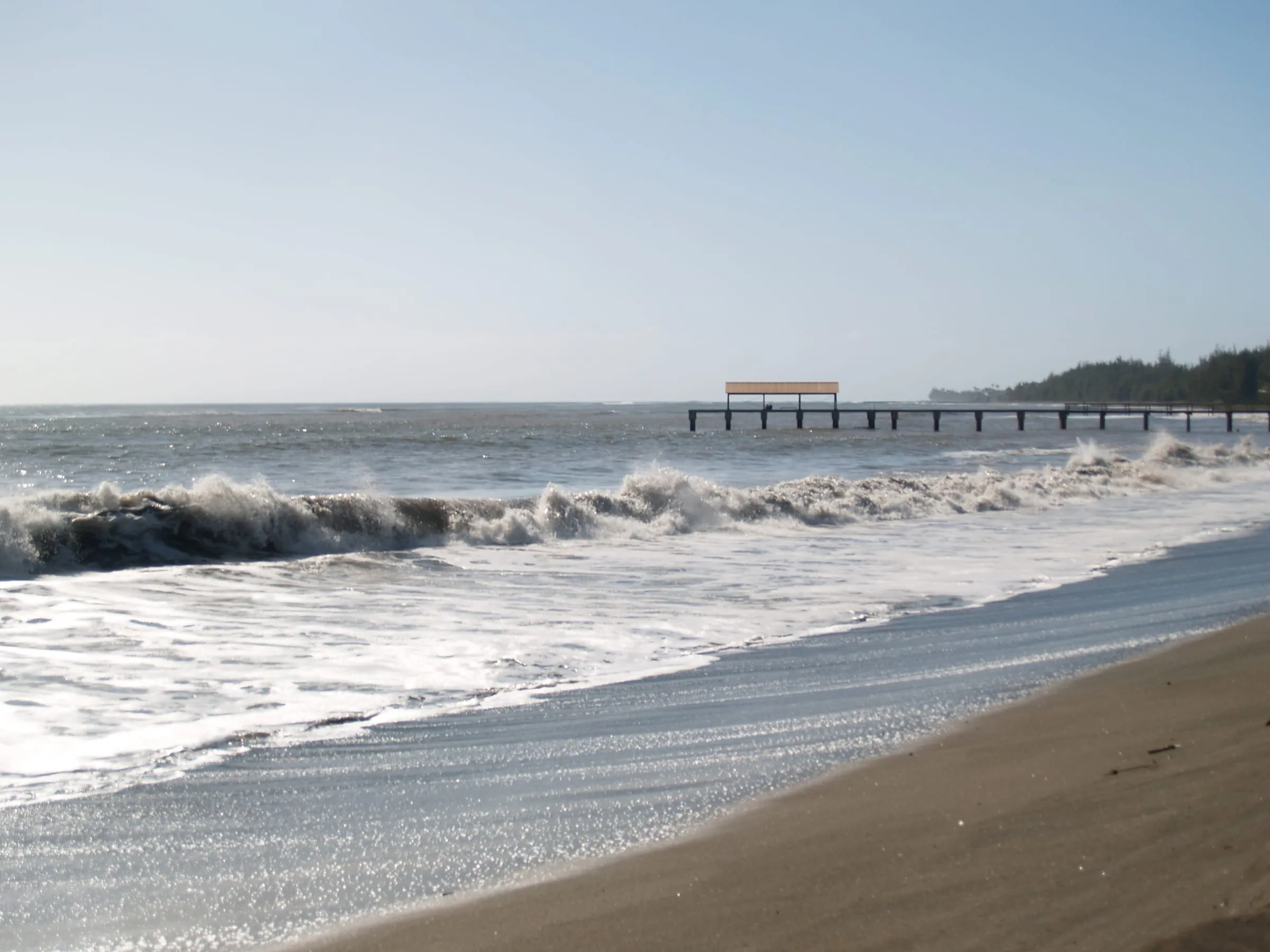
On the biggest days it goes further. On 24 March 2025, in a High Surf Warning, it advised no swimming at every North Shore beach from ʻAnini westward, and on 11 and 12 November 2026, under a High Surf Advisory, along all north- and west-facing shores. Each took in the whole bay. So the winter plan here is the pavilion tower, on a day the lifeguard says yes, and the rest of the two miles for walking and watching. The photograph at the end of this page, taken on a February day in 2008, shows the winter bay breaking white in front of the pier.
On the day, the answer is the lifeguard at the tower. The county also points to Safe Beach Day’s Hanalei & Hanalei Bay hazard rating and to the Ocean Safety Bureau’s line, (808) 241–4984. In winter, the south shore faces away from the swell, which is why our snorkeling page sends winter snorkelers to Poʻipū.
After the rain
The Hanalei River reaches the sea at Black Pot, beside the pier, and it brings down the North Shore’s rain. Hanalei averages 86.4 inches of rain a year at the Weather Service’s gauge, more than 5 inches in every month and 9.3 in November, against about 36 at Līhuʻe and Poʻipū (best time to visit Kauaʻi has every month). The lifeguards note that the major flooding here comes with the winter rains, from October through March.
After a heavy rain the river runs brown into the bay. On 20 July 2025, under a Flash Flood Warning, the county advised no swimming or water activity on any north-facing shore of the island because of brown water runoff. Keep out of water that has turned brown, whatever the sky is doing by then; ocean safety has the Health Department’s advice on how long to wait.
The pier
Hanalei Pier runs about 340 feet out from the sand at Black Pot, a concrete finger pier with a roofed shed at its end, and it is on the National Register of Historic Places, listed in 1979. Its nomination tells the story.
- It was a rice pier. By 1892 Hanalei and Waiʻoli had 750 acres in rice, the largest rice-growing district in Hawaiʻi, and the pier carried the crop to Honolulu, a seasonal trade.
- The pier there now dates from 1912. It was built with a wooden deck, replacing a shorter pier older than 1892. The legislature put $25,000 into a concrete deck in 1921, and the contractors finished it in late 1922.
- Shipping ended in the 1930s. The nomination gives two dates: the pier was abandoned in 1933, after years of little use, and it has not been used for shipping since the late 1930s. The shed at the end went up in 1940, and in 1979 rails still ran down the pier’s sunken center section, laid only to serve the pier itself.
- It has been in several films, South Pacific the best known of them.
Today it is a state boating facility, listed with the bay’s offshore mooring area (“Hanalei Pier — no moorings”). Since the boats stopped it has been the beach’s own pier, used, as the nomination put it in 1979, “by fishermen and persons using the beach.” On the county’s big-surf days of 5 and 6 November 2026, the water at the pier was one of the two places in the bay where it still permitted a swim.
Getting there, and the bridge that floods
From the rental car lots at Līhuʻe Airport, Hanalei town is 30.7 miles, about 55 minutes on a clear road; getting around Kauaʻi has every drive and the bus. Past Princeville, Kūhiō Highway drops into the Hanalei Valley and crosses the Hanalei River on a one-lane bridge, the only road in. The pier, all three beach parks and Hanalei town are past it. Princeville, on the bluff above the bay’s east end, is on the near side.
When the river floods, the highway is closed at the bridge until the water drops, sometimes for a morning and sometimes overnight. It closed in July 2025, and four times between 7 September and 31 October 2026, from Hurricane Lowell on. The first of those four was the longest: fallen utility poles followed the flood of 7 September and kept it shut until crews cleared an emergency access lane on 9 September, and the state reported the highway open to the end of the road on 11 September. Whether it is open today is on what is open on Kauaʻi, with every closure since the storm.
What a closed bridge means for a trip built around the bay:
- Staying in Hanalei, Wainiha or Hāʻena: you cannot drive out until it reopens, not to the airport, not to Līhuʻe, not to a boat on the west side. On the day you fly home, leave hours, not minutes, between checkout and the flight, and with a storm warning out, days.
- Staying in Princeville or further east: the beach parks, the pier, Hanalei town and the check-ins for both trips below are on the far side.
- Bound for Keʻe: the end of the road is past the bridge too, and so is Waipā Park & Ride, the North Shore shuttle’s main stop; Hāʻena State Park reservations has the shuttle and the passes.
- The lifeguards: on 20 July 2025, with the highway closed near the bridge, the county’s notice read: “all lifeguard towers except for Hanalei Bay are closed.”
On the water: the two trips from the bay
Two trips we link go out on the bay itself, and both are at the foot of this page. The check-in for each is in Hanalei town, past the bridge.
Kayak Hanalei’s kayak and snorkel. You paddle a tandem kayak from the company’s own dock on the Hanalei River down into the bay, look for green sea turtles, then land on a beach inside the bay for 45 minutes of guided snorkeling and a deli lunch on the sand, five hours in all from check-in at its shop in Hanalei town. Every guest paddles and gets in and out of the kayak unaided. When we read its calendar on 11 November 2026 it had dates from 17 November to the end of January and none from February to October 2027, and a winter date is one the swell can cancel: book it early in your stay.
Hanalei Charters’ Nā Pali boat. Hanalei Bay is, in the operator’s words, “a natural port without loading docks,” so you wade out from the beach through waist-deep water and climb a ladder aboard without help. The trip is three hours along the Nā Pali, sightseeing with no snorkel stop, with check-in at its parking area in Hanalei town from 8 a.m. It had dates on sale on most Mondays to Saturdays from 23 November 2026 to 27 February 2027 when we read it on 11 November. Nā Pali Coast boat tours sets the Hanalei boats against the west-side ones from Port Allen.
Where to stay for the bay
Princeville is the nearest resort base, and it is on the near side of the bridge. 1 Hotel Hanalei Bay, at 5520 Ka Haku Road, is Princeville’s resort hotel on the bluff above the bay, and it is on Booking.com, below.
Hanalei town itself is outside every one of the county’s Visitor Destination Areas, so a whole house there may rent to visitors only under a TVNC certificate. Is that Kauaʻi vacation rental legal? shows how to tell from the ad, and where to stay on Kauaʻi sets the North Shore against Poʻipū and the east side.
Before you go
- Swim in front of a tower, in its hours, and ask the guard first. That means the pavilion or Waiʻoli, from 8 a.m. to 6 p.m.
- The lots close for repairs about once a year, over two mornings in a row, announced a day to a week ahead: in September 2023, and in January in 2024, 2025 and 2026, from 5 a.m. to between 10 and 11 a.m.
- Further along the coast, Tunnels and Keʻe are the North Shore’s reef beaches, both past the bridge.